The City of Auburn's Information Technology Department has released a new version of its web-based interactive map.
The city will offer two free seminars to train the public on its use and to help residents discover all the information available at their fingertips.
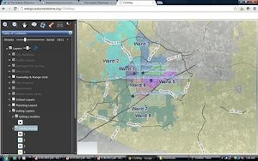
This system is a new version of the city's web-based interactive map and has taken the place of the existing General Interactive Map.
Residents can use the COA map to see their property information and parcel lines; determine their voting ward, voting location and City Council representative; determine their school district; show their proximity to flood plains and much more.
Auburn plans to add integration of live camera feeds, emergency equipment locations, room capacities and other relevant campus information. Auburn's GIS Manager,
Christopher Graff, explained that citizens currently use the COA map for a multitude of things.
"Students and staff at Auburn University use it in class projects; citizens use it to discover where to vote, what day of the week garbage pickup is and to investigate how their property has changed over time."
Graff will lead the two workshops. The format will be a brief introduction to the City's GIS Division, including what they do and how they do it. Graff will then give a formal demo of the COA Map to show the various tools, capabilities and information available.
The training will be followed up with a question and answer session. Graff then plans to divide up the citizens "and allow folks to try the application for themselves on a number of computers we'll have set up," Graff said.
The City of Auburn's Information Technology Department will host these seminars Nov. 6, from 5:30-6:30 p.m. and November 13, from 3-4 p.m.
There are no prerequisites or background needed to attend.
Graff hopes for the workshops to be "comfortable and relaxed, and non-technical in nature, so that we might present the application to as wide an audience as possible."
There will be staff members available to address specific or technical questions.
Each will be held in the City of Auburn Meeting Room located at 122 Tichenor Avenue.
The map can be accessed at webgis.auburnalabama.org/COAMap/
Do you like this story? The Plainsman doesn't accept money from tuition or student fees, and we don't charge a subscription fee. But you can donate to support The Plainsman.