April 29, 10:53 p.m.
The National Weather Service says severe weather chances are "low" tonight throughout central Alabama.
Severe weather was originally forecast to arrive in the Auburn area at 9 p.m., but there are currently no tornado or severe thunderstorm warnings across the entire state of Alabama.
According to Birmingham-based meteorologist James Spann, the air in front of the storms is not conducive for severe weather Tuesday night.
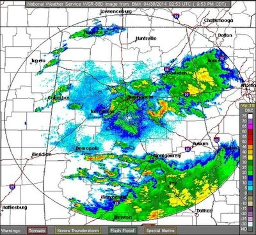
RT @spann: No severe weather so far; looks like the air is a bit too stable for a major event tonight. pic.twitter.com/x14s3WLXv5
-- The Auburn Plainsman (@TheAUPlainsman) April 29, 2014
Lee County, along with most of Alabama and Georgia, is under a flash flood watch until 7 a.m. Wednesday. Residents should be aware of heavy rain throughout the night and the possibility of flooding, which impacted parts of the Mobile and Pensacola, Fla., region Tuesday night.
_______________
April 29, 12:33 p.m.
According to its latest update, the National Weather Service in Birmingham's storm tracker has severe weather arriving in the Auburn area sometime after 9 p.m. Tuesday.
The NWS issued a "Hazardous Weather Outlook" Tuesday morning that had severe weather first impacting central Alabama starting at 2 p.m.
That outlook appears to be for the western part of the state as another slow-moving system may not arrive in Auburn until late Tuesday night.
_______________
April 29, 11:39 a.m.
Another strong line of severe thunderstorms could affect Auburn as early as 2 p.m. Tuesday, according to the latest bulletin from the National Weather Service.
The NWS in Birmingham issued a "Hazardous Weather Outlook" late Tuesday morning for more than 30 counties across central Alabama.
"Another round of severe weather will be possible for all of central Alabama starting around 2 or 3 p.m. this afternoon and lasting through about midnight," the bulletin states.
Once again, tornadoes, damaging winds and hail are all possible for this upcoming round of storms.
"We will still see a cold front slide through this afternoon," the NWS released through social media. "The sun this morning and early afternoon will not be our friend and could help destabilize the environment. If the air mass does destabilize then we could see additional severe weather including tornadoes."
Flash flooding continues to be a possibility in Lee County, according to the NWS. The county remains under a flash flood watch until 7 a.m. Wednesday.
We will continue to provide updates throughout the day on this page and on Twitter @TheAUPlainsman.
_______________
April 29, 5:00 a.m.
The tornado watch has been cancelled for Auburn University. There is another chance of severe weather forecast from 3 p.m. to midnight.
We will continue to provide updates throughout the day on this page and on Twitter @TheAUPlainsman.
_______________
April 29, 3:57 a.m.
The National Weather Service has issued a new tornado warning for the southeastern part of Lee County. This new warning does not include Auburn or Auburn University.
Areas impacted by the new warning include Smiths Station and Phenix City. A tornado has not been spotted on the ground in Lee County.
_______________
April 29, 3:47 a.m.
The National Weather Service has now canceled the tornado warning for Lee County.
The county is still under a tornado watch until 5 a.m.
_______________
April 29, 3:36 a.m.
The National Weather Service has issued a tornado warning for Lee County until 4 a.m.
WSFA News out of Montgomery is reporting a tornado sighting 12 miles south of Auburn, near Society Hill.
THE NATIONAL WEATHER SERVICE WAS TRACKING CONFIRMED TORNADO NEAR SOCIETY HILL...OR 12 MILES SOUTH OF AUBURN. DOPPLER RADAR SHOWED THIS TORNADO MOVING NORTH AT 50 MPH.
_______________
April 29, 2:42 a.m.
The National Weather Service has extended the tornado watch for Lee County until 5 a.m.
The line of storms recently passed through Montgomery County, where there was a tornado warning.
Lee County is also still under a flash flood watch.
Auburn University Emergency Management has announced both the Draughon Library and Greene Hall will stay open throughout the duration of the tornado watch.
_______________
April 29, 12:08 a.m.
Auburn University Public Safety and Security has released a bulletin on the severe weather situation:
"The National Weather Service has issued a Tornado Watch for Lee County, Alabama, including Auburn University, until 3:00 a.m. CDT. Severe weather is not expected in Auburn until close to that time and the Tornado Watch may be extended...This round of storms is expected to be out of the Auburn area before 8:00 a.m. CDT Tuesday, so there are currently no anticipated impacts to classes or campus operations."
_______________
April 28, 11:34 p.m.
A tornado watch has now been issued for Lee County until 3 a.m.
Greene Hall at the College of Veterinary Medicine and Draughon Library on the main campus will be open through the duration of the watch.
_______________
April 28, 10:48 p.m.
The expected arrival for the severe weather in Lee County has been pushed back to "as early as 3:30 a.m.," according to the Lee County Emergency Management Agency's Facebook page.
"At this time Lee County is not under [tornado] watches or warnings," the Lee County EMA posted. "However, the storm system is moving much slower than anticipated and the current radar indicates that we could see the [effects] of the storms as early as 3:30 a.m."
Lee County is still under a flash flood watch, along with most of the state.
_______________
April 28, 7:35 p.m.
According to the National Weather Service, severe weather is forecasted to arrive in Auburn and the Lee County area around midnight Tuesday.
Lee County is currently under a flash flood watch and is expected to go under a tornado watch in the coming hours.
The slow-moving storm system that has affected several areas throughout the Southeast and North Alabama, where several tornadoes were reported Monday.
Storms moving slowly into AL. Not expecting severe in Auburn until after midnight or 1am. Make sure your NOAA weather radio is on tonight!
-- AU Emergency Mgmt (@AUEmergencyMgmt) April 29, 2014
The severe weather threat has a chance of tornadoes, damaging straight-line winds and large hail throughout the early hours of Tuesday morning
In the event of a tornado watch, Greene Hall at the College of Veterinary Medicine will be open. Draughon Library on the main campus will be open 24 hours.
Alabama governor Robert Bentley has issued a state of emergency for all Alabama counties as a response to the damage from severe weather throughout the state.
"Some of our communities have already experienced significant damage as a result of the tornadoes that began moving through Alabama earlier today " Bentley said in a statement. "By issuing a State of Emergency, I am directing all state agencies to take necessary actions to respond to Alabama communities that need help."
Stay here for updates throughout the night.
Do you like this story? The Plainsman doesn't accept money from tuition or student fees, and we don't charge a subscription fee. But you can donate to support The Plainsman.