Hurricane Michael has been upgraded to a Category 4 storm, with wind speeds reaching up to 145 miles per hour, making it the most powerful storm to ever hit the Florida Panhandle.
The storm is expected to make landfall along the Panhandle of Northwest Florida Wednesday, raising the threat of powerful winds and storm surges as high as 13 feet in some areas.
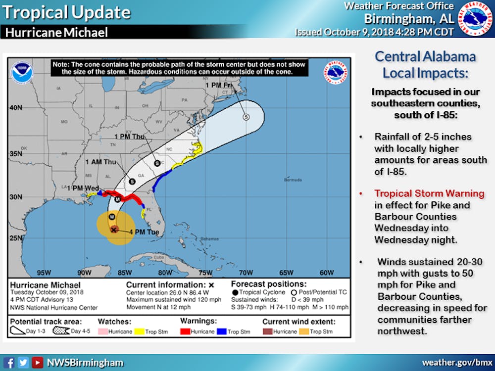
Michael's path takes it to the east of Auburn, through South Georgia, but the outer bands of the storm could still have an impact on the area. The storm will have weakened by the time its effects are felt in Auburn.
The National Weather Service has forecast heavy rain, strong winds and wind gusts, and the possibility of localized flooding.
Gov. Kay Ivey has declared a state of emergency ahead of the storm's arrival. Auburn could begin feeling its effects Wednesday through Thursday.
Auburn University Campus Safety and Security said again Tuesday that it does not expect class cancellations because of the storm.
Auburn Athletics has canceled Tipoff on Toomer's because of potential dangers to crews who would set up the event that was scheduled for Thursday.
There will be no classes on Thursday or Friday as Auburn observes fall break.
"If traveling for Fall Break, monitor the forecast closely and adjust travel plans accordingly," Campus Safety tweeted. "It may be safest to delay travel until the storm has passed. Residence halls and some campus dining facilities will be open throughout the Fall Break."
Do you like this story? The Plainsman doesn't accept money from tuition or student fees, and we don't charge a subscription fee. But you can donate to support The Plainsman.